This map shows the location of each of the Reaches, starting from 1 in the west to 12 in the east. Chainage is marked here to give a sense of how long each of the proposed alternatives would be. Chainage is marked in meters. (e.g. Reach 1 is 220 m long, Reach 2 is 320 m long, etc.).
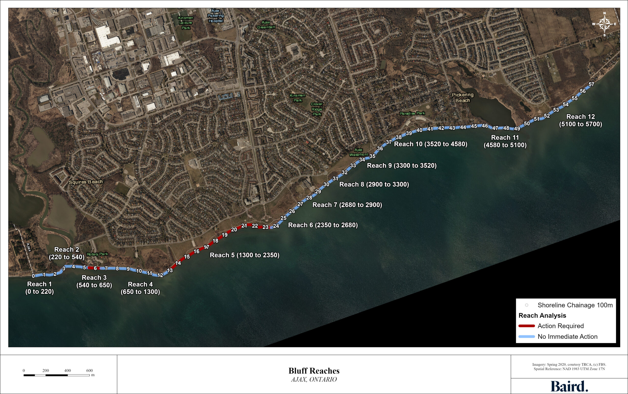
Reach 1 & 2:
Frisco Road to Rotary Park
- 1 of 6
Reach 3 & 4:
Rotary Park to Lion’s Point
- 2 of 6
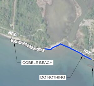
Reach 5 & 6:
Loin’s Point to Veteran’s Point Gardens
- 3 of 6
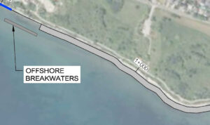
Reach 7, 8 & 9:
Veteran’s Point Gardens to Paradise Beach
- 4 of 6
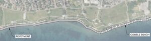
Reach 10 & 11:
Paradise Beach to Carruthers Marsh
- 5 of 6
Reach 12
Carruthers Marsh to Ontoro Boulevard
- 6 of 6
Reach Locations

Reach 1 & 2:
Frisco Road to Rotary Park

Reach 3 & 4:
Rotary Park to Lion’s Point

Reach 5 & 6:
Loin’s Point to Veteran’s Point Gardens

Reach 7, 8 & 9:
Veteran’s Point Gardens to Paradise Beach

Reach 10 & 11:
Paradise Beach to Carruthers Marsh

Reach 12
Carruthers Marsh to Ontoro Boulevard