Ward’s Island
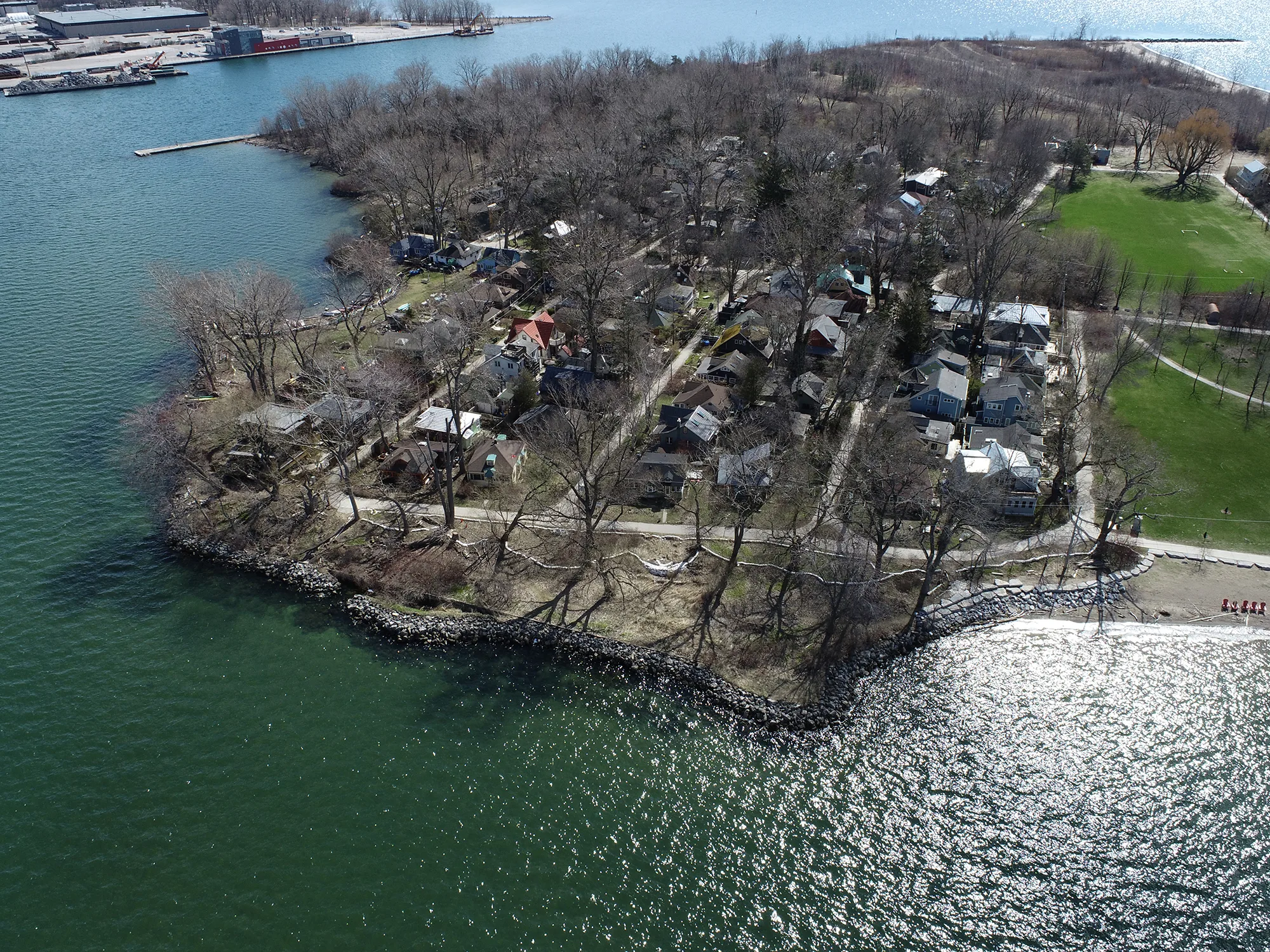
Ward's Island is the easternmost area of Toronto Island Park. It features a ferry terminal, residential neighbourhood, beaches, and several naturalized areas that are part of Ward's Island Park. One focus area has been identified for Ward’s Island based on flood risk to existing infrastructure; this includes the ferry terminal and residential section of the island. Areas excluded from the scope include Ward's Island Park and Ward's Island Beach. These locations are subject to flooding during the 100-year flood event; however, they are uninhabited with no major infrastructure and therefore flood impacts are considered low.

Ward’s Island Existing Conditions
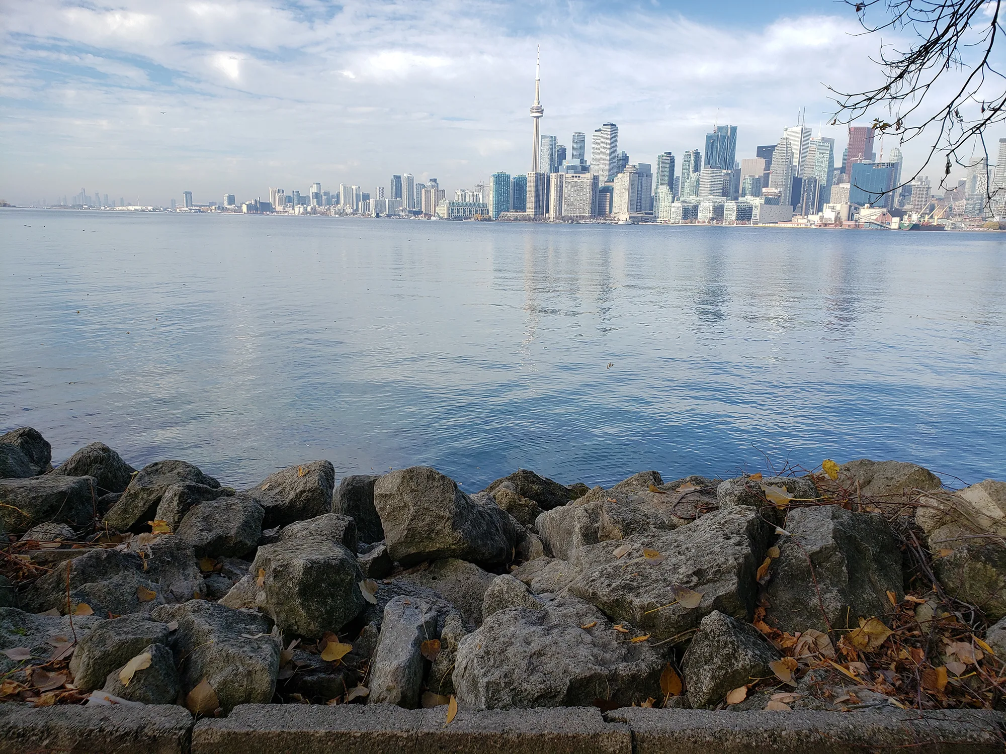
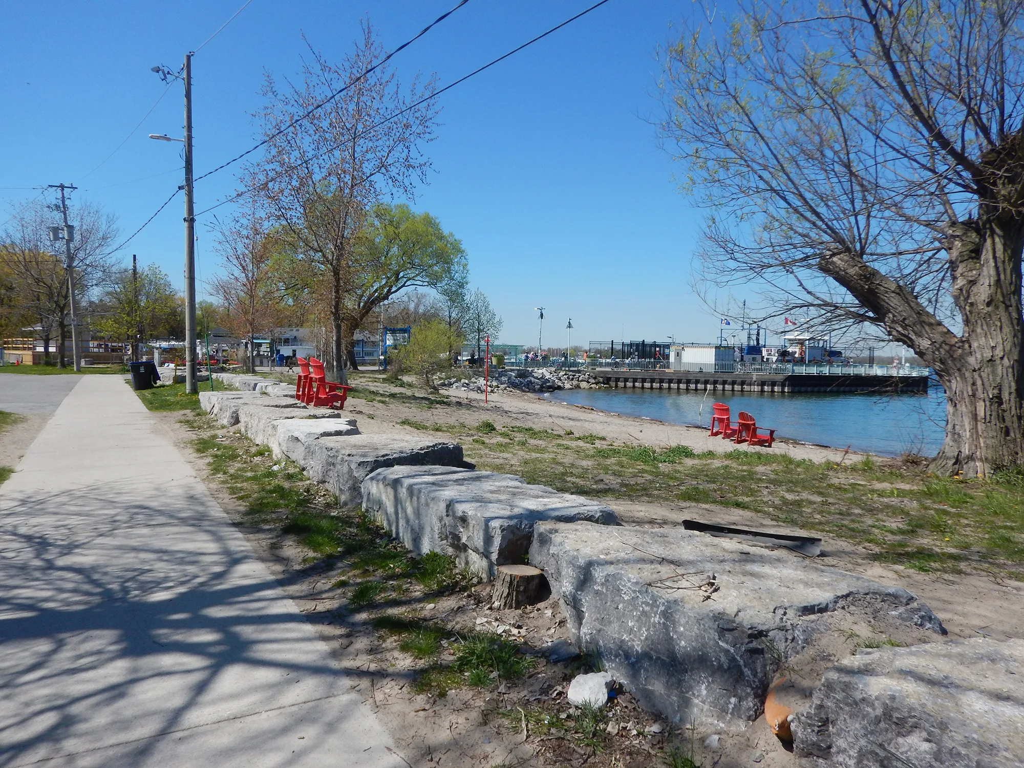
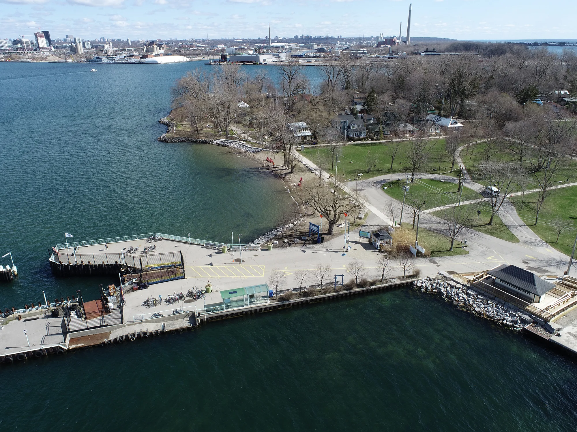
Ward’s Island is relatively low-lying and is vulnerable to flooding during high lake levels. There are several existing structures installed around the shoreline; however, most structure heights are too low to provide adequate flood protection. Sandbags were placed in many areas along the shoreline during 2017 and 2019 to reduce flooding impacts. As part of the emergency works in 2020, a beach curb was installed north and south of the ferry terminal, including a rip rap and armourstone revetment at the north end of the beach.
What we heard
A range of alternative concept designs were presented for this focus area, including a steel sheet pile wall, a vegetated berm, or a vegetated berm with a beach and groyne system that had several variations depending on its scale.
During the first round of engagement, the vegetated berm was presented as the highest ranked concept. Feedback we received indicated there was preference for improving recreational and ecological features as part of the design in this area.
The concept evaluation was updated to better reflect this input and the final preferred solution was identified as the smallest scale version of the vegetated berm with a beach and groyne because it offers improved ecological and recreational value while minimizing impacts to the residential area. This final solution is similar to the vegetated berm that was initially presented since it still sees the berm installed around the project area as the primary flood protection measure.
Preferred Concept Solution: Vegetated Berm, Beach and Groyne
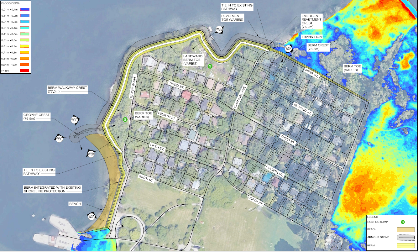
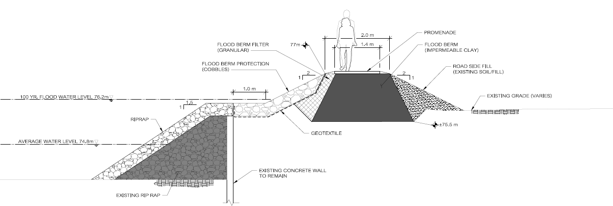
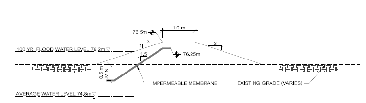
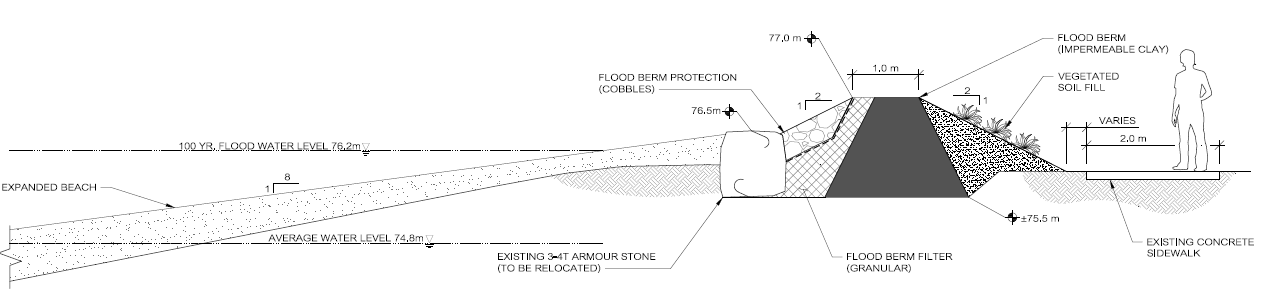
The preferred solution for Ward’s Island is a vegetated berm with a beach and groyne. This solution involves a vegetated berm that will follow the shoreline and then move inland to follow the perimeter of the residential area. The section of the berm along the shoreline will be supported by a rip rap revetment (cross-sections W3E and W3F). Although not a part of the TRCA Class EA, the top of the berm can be designed to include a walking path in strategic locations should this be desired as part of the Toronto Island Park Master Plan process.
This solution also involves enhancing the existing beach that is located north of the ferry terminal (cross-section W3A and W3B). The expanded beach will be held in by the ferry wharf to the south and by a new stone groyne to the north (cross-sections W3C and W3D). Aquatic habitat features will be incorporated into the design for added ecological value. Efforts will be made to minimize impacts on existing mature vegetation, remove invasive species, and restore native species involving the community and relevant City departments through the detailed design and permitting process.
The map shows how this solution will protect the Ward’s Island shoreline in the event of another flood. With this solution in place, the key focus areas will be protected from flooding impacts. Ward’s Island Park and Ward’s Island Beach will be left unprotected and allowed to flood naturally since there is no essential infrastructure in these areas.


Detailed Environmental Analysis
The categories below summarize anticipated impacts of the proposed solutions for flood mitigation at Ward’s Island. Interested in learning more? Click here to view the full Detailed Environmental Analysis for Ward’s Island.
Physical Environment
- Installation of the groyne will improve sand retention
- The installation of impermeable flood barriers around the shoreline of the study area will impede surface drainage to the lake. The addition of sump pumps or other considerations will need to be reviewed during detailed design to mitigate this impact
- Noise and vibration impacts are expected during construction, but these will be temporary
Biological Environment
- Overall impacts are expected to be positive
- The incorporation of aquatic habitat features and native plantings will benefit wildlife, fish habitat, and vegetation communities
- Installation of the inland berm along First Street will have a slight negative impact on the edge of the Environmentally Significant Area and Candidate ANSI that are located here. These impacts can be mitigated by the incorporation of native plantings into the design
Cultural Environment
- Overall impacts are expected to be positive
- Recreational opportunities, aesthetic features, and access to the shoreline will be improved and enhance park user experience
Socioeconomic Environment
- Improvements to the shoreline and incorporation of a walkway in strategic locations if desired will enhance visitor use and maintain accessibility during a flood event
- Increased recreational use may impact residents and place additional demand on existing infrastructure
Engineering/Technical Environment
- Overall impacts are expected to be positive
- Erosion and flood risks will be reduced
- Existing shoreline infrastructure will be improved
- Beach retention will be improved
Explore Other Study Areas

Centre Island
Review the preferred solution and impact assessment.

Algonquin Island
Review the preferred solution and impact assessment.

Roadways
Review the preferred solution and impact assessment.