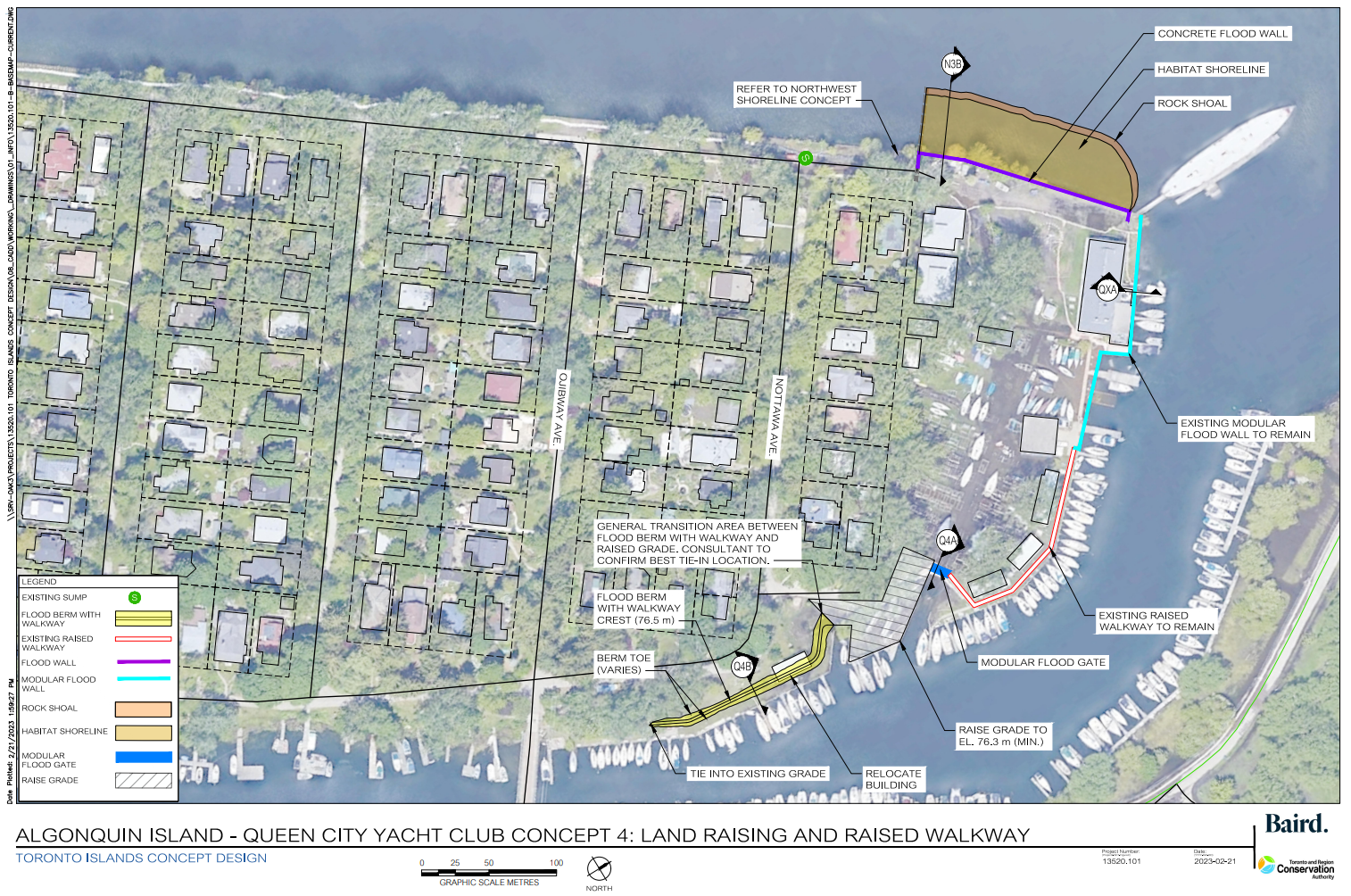
Queen City Yacht Club
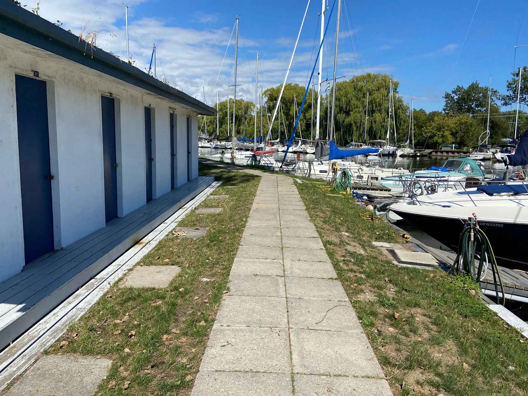
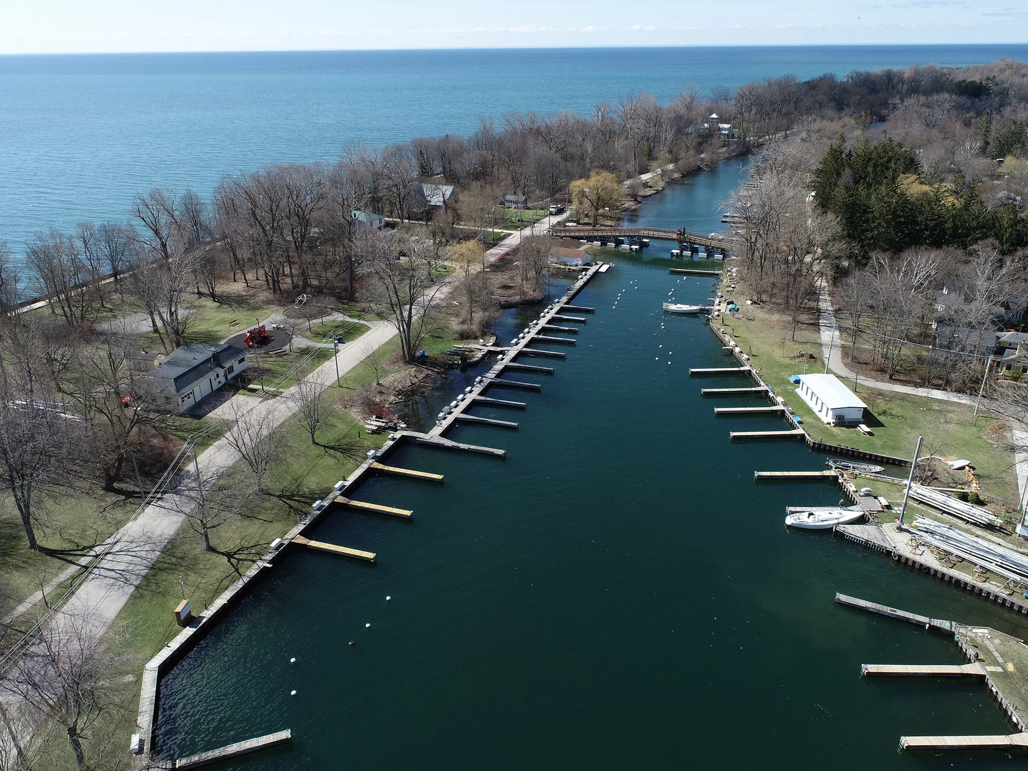
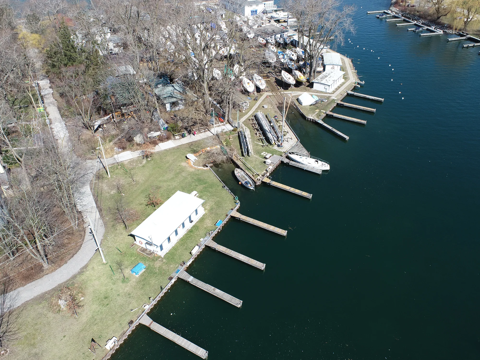
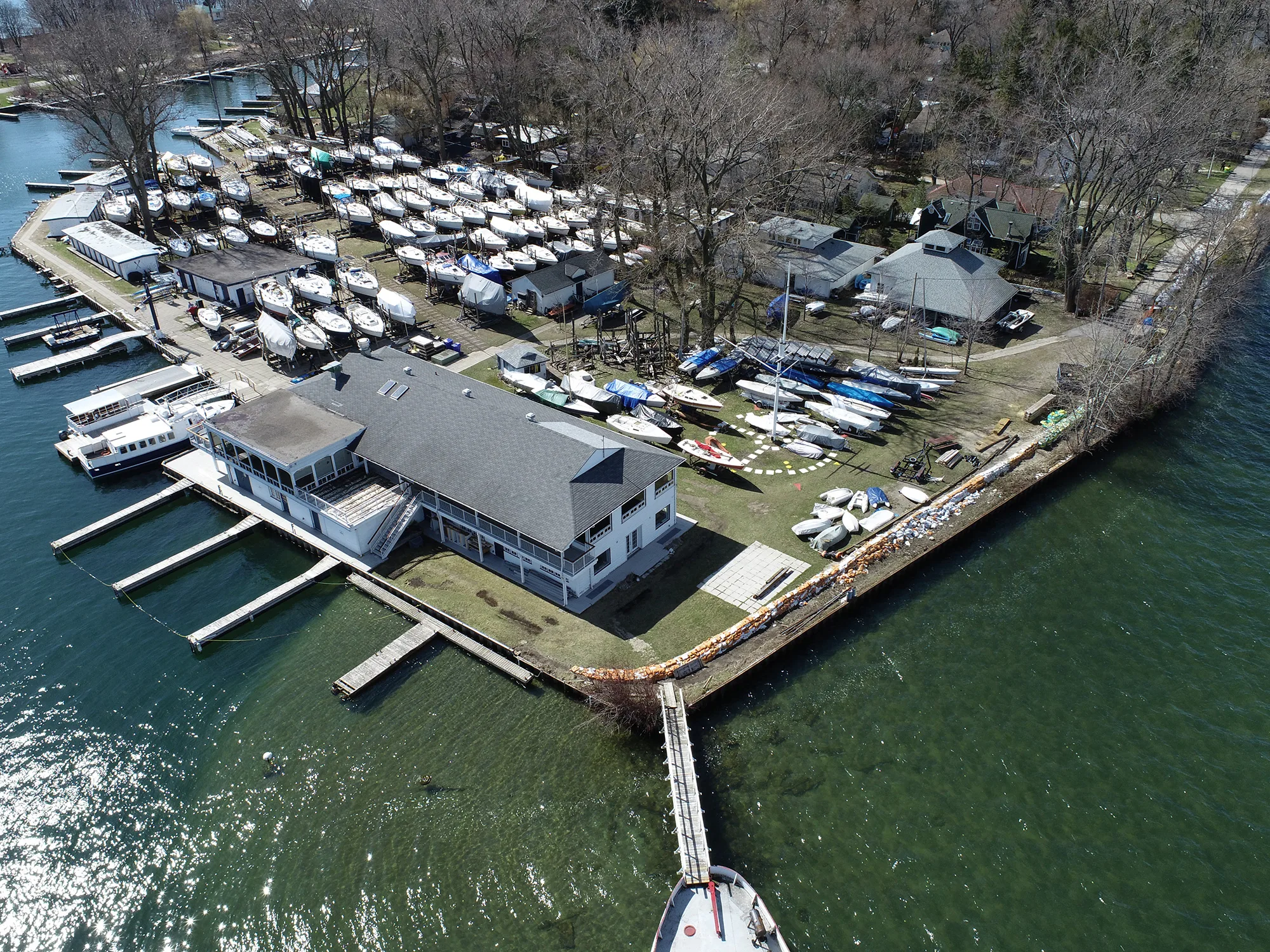
Queen City Yacht Club (QCYC) is located on the northeast end of Algonquin Island. The shoreline is surrounded by steel sheet piling and floating docks. A pathway and many facility buildings are located adjacent to the shoreline.


What we heard
A range of alternative concept designs were presented for this focus area, including a steel sheet pile wall, a concrete dock wall, or an inland floodwall. Following the first round of public engagement and additional site review, it was determined that a new concept was required to better meet site conditions and operational needs. This new concept was developed and selected as the preferred alternative in response to the feedback we received.
Preferred Concept Solution: Land Raising and Raised Walkway
The preferred solution for Queen City Yacht Club is land raising and a raised walkway.
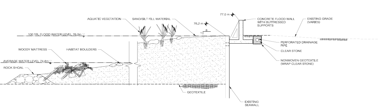
As part of this solution, the habitat shoreline from the neighbouring Northwest Shoreline focus area will extend along the northwest end of the site. Due to space limitations, a buttressed flood wall will be placed along the existing seawall instead of a vegetated berm (cross-section N3B).
Along the northeastern border of the site, QCYC has already implemented various solutions that allow for maintained operations during flood levels. This concept proposes that QCYC's existing modular flood wall and raised walkway remain in place to provide flood protection along this section of the shoreline.
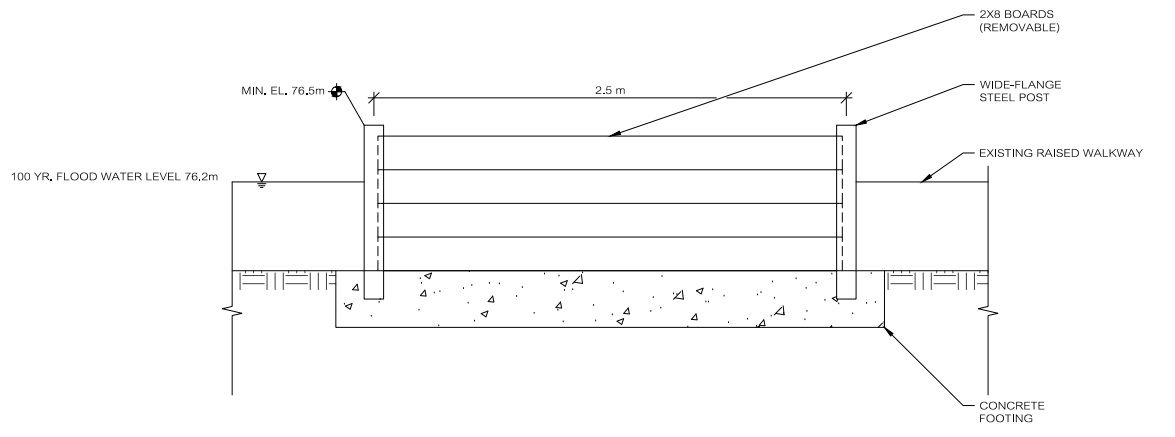
A modular flood gate will be added as a non-permanent measure to block off the marine railway slip during high water level events (cross-section Q4A). To the south of the marine railway, a localized section of land will be raised above the 100-year flood level.
Lastly, a berm with a pathway will be placed along the southeastern shore to create a raised walkway which will protect this area from flooding while maintaining access to the dock slips (cross-section Q4B).

Algonquin Island Focus Area
Select a focus area to learn more about the preferred concept solution.
Explore the Study Areas

Centre Island
Review the preferred solution and impact assessment.

Ward’s Island
Review the preferred solution and impact assessment.

Roadways
Review the preferred solution and impact assessment.