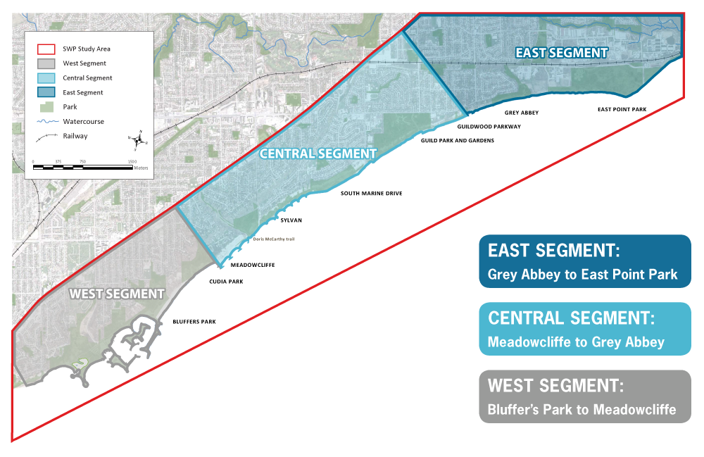
The project is focused along the shoreline, from the top of the Scarborough Bluffs down to the water’s edge and along the bluff face, with additional consideration given to required shoreline access points along the way.
Due to the length of the shoreline studied, the project study area was broken down into three distinct segments to aid in the ‘Alternative Methods’ development and evaluation process during the EA phase. These are referred to as the West, Central and East Segments.
Detailed design and construction along the shoreline will be implemented in phases. As directed by City Council in May 2018, the project will commence first with the design and construction of the West Segment.
The SWP West Segment includes the shoreline between Bluffer’s Park and the existing Meadowcliffe headland-beach system.
This segment has been broken down into sub-components for design and construction:
- The West Segment Shoreline and Multi-Use Trail Project.
- The Brimley Road South Multi-Use Trail Project.
West Segment: Bluffer’s Park to Meadowcliffe
The West Segment Shoreline and Multi-Use Trail Project will provide an enjoyable waterfront experience and safe public access along the shoreline between Bluffer’s Park and Meadowcliffe, with an eventual connection to the SWP’s Central Segment (Meadowcliffe to Grey Abbey).
Brimley Road South Multi-Use Trail Project
The Brimley Road South Multi-Use Trail Project will provide safe pedestrian and cyclist access to Bluffer's Park for thousands of annual visitors. A virtual Public Open House for the Brimley Road South Multi-Use Trail was hosted in December 2021 and the materials shared remain online. This portion of the project is currently moving through the 90% design phase and additional engagement with impacted community members is underway. A project status update, with anticipated construction timelines, is expected to be available by August 2023. As Brimley Road will be the only construction access route for the shoreline works, it is imperative that the trail be implemented in advance to facilitate safe pedestrian and cyclist access during shoreline construction.

