Key Issues
Access to Bluffer's Park
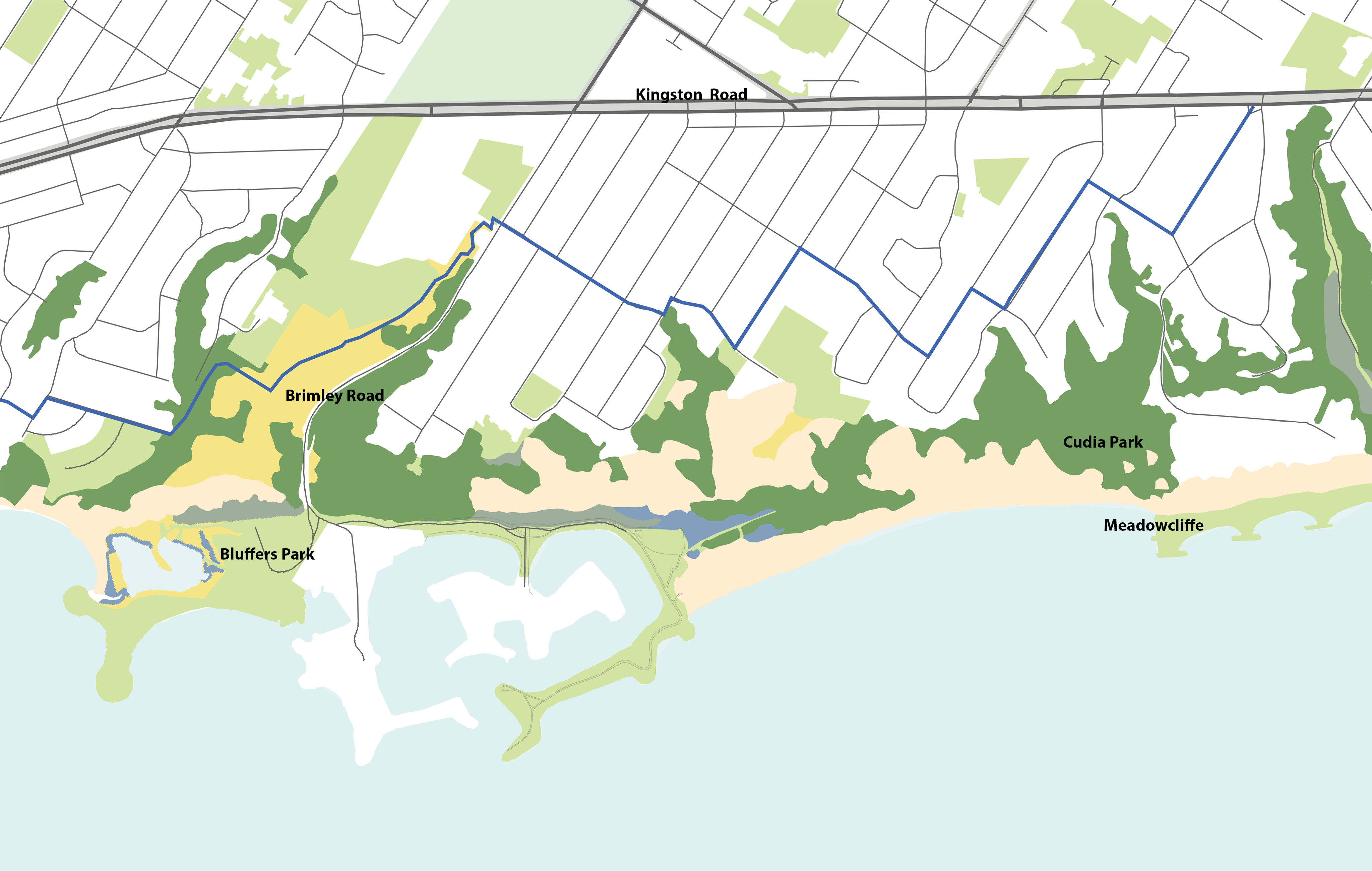
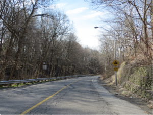
The steep grades and lack of pedestrian and cyclist infrastructure along Brimley Road do not provide safe park access to users. Brimley Road is the only formal entry point into Bluffer's Park and will be the primary access point for future shoreline construction.
- 1 of 8
Sand Buildup in the Navigation Channel
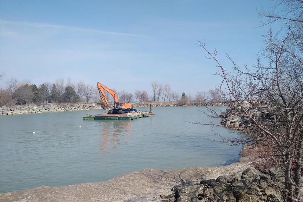
The Bluffer's Park sand beach is currently at capacity for sand retention. As a result, all the sand moving along the nearshore accumulates in the harbour entrance, creating unsafe boating conditions for users of the marina. Dredging activity is undertaken by the City of Toronto every one or two years to manage the risk in the interim.
- 2 of 8
Beach Flooding
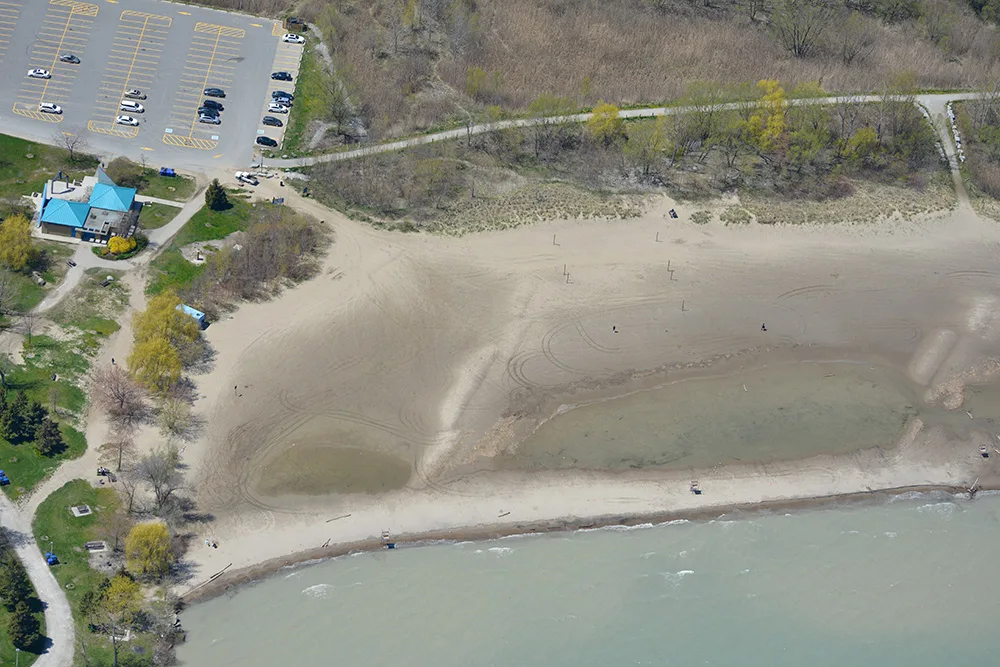
Under high water level conditions, the beach is subject to flooding with large areas becoming saturated with water, creating an undesirable user experience.
- 3 of 8
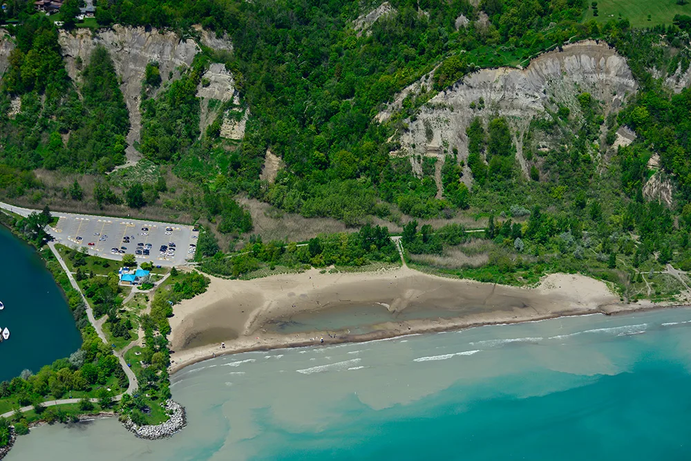
Low Diversity of Aquatic Habitat
The existing aquatic habitat along the shoreline between Bluffer's Park to Meadowcliffe lacks substrate and shoreline profile diversity, and currently supports a very small number of open coast fish species.
- 4 of 8
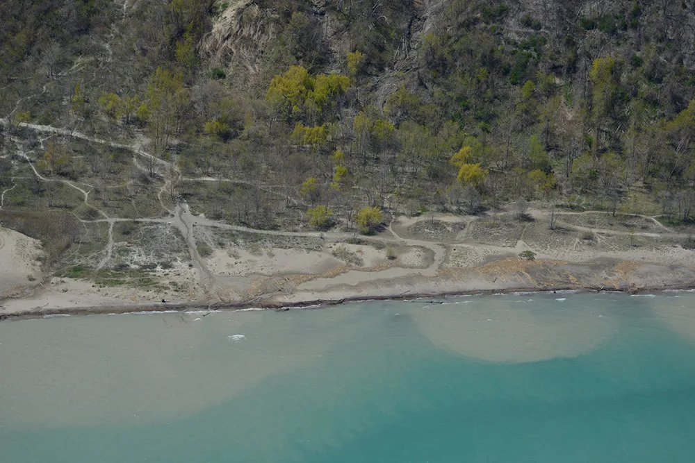
Informal Trails and Terrestrial Habitat Degradation
The existing beach and backshore vegetation communities are frequently trampled and severely fragmented by a large number of informal trails due to unmanaged public usage.
- 5 of 8
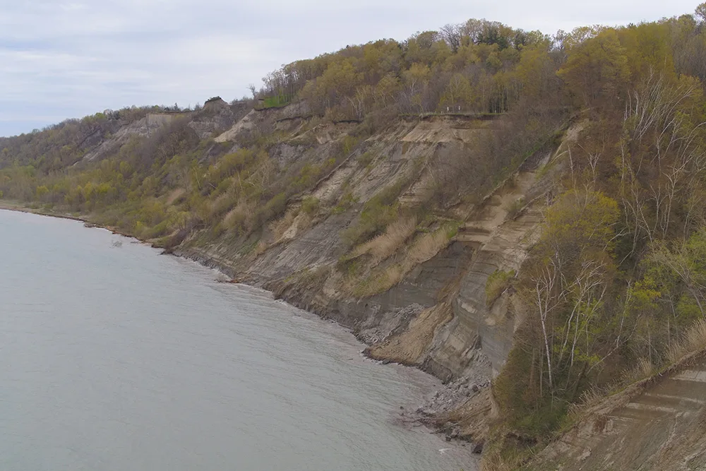
Risk to Public Safety
As no shoreline protection is in place, there is continuing bluff toe erosion, slope failure, and crest migration along the Cudia Park Bluff. Users of the shoreline east of the beach are at risk due to the resulting landslide activity.
- 6 of 8
Lack of Access Between Bluffer's Park and Meadowcliffe
There is currently limited access along the shoreline, making it challenging and unsafe for users to reach Meadowcliffe from Bluffer's Park Beach.
- 7 of 8
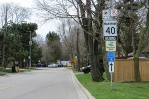
On-Road Great Lakes Waterfront Trail
The Great Lakes Waterfront Trail route currently runs on-road along residential streets in the surrounding community.
- 8 of 8
Key Issues
Access to Bluffer's Park

Issue: The steep grades and lack of pedestrian and cyclist infrastructure along Brimley Road do not provide safe park access to users. Brimley Road is the only formal entry point into Bluffer's Park and will be the primary access point for future shoreline construction.
Sand Buildup in the Navigation Channel

Issue: The Bluffer's Park sand beach is currently at capacity for sand retention. As a result, all the sand moving along the nearshore accumulates in the harbour entrance, creating unsafe boating conditions for users of the marina. Dredging activity is undertaken by the City of Toronto every one or two years to manage the risk in the interim.
Beach Flooding

Issue: Under high water level conditions, the beach is subject to flooding with large areas becoming saturated with water, creating an undesirable user experience.
Low Diversity of Aquatic Habitat

Issue: The existing aquatic habitat along the shoreline between Bluffer's Park to Meadowcliffe lacks substrate and shoreline profile diversity, and currently supports a very small number of open coast fish species.
Informal Trails and Terrestrial Habitat Degradation

Issue: The existing beach and backshore vegetation communities are frequently trampled and severely fragmented by a large number of informal trails due to unmanaged public usage.
Risk to Public Safety

Issue: As no shoreline protection is in place, there is continuing bluff toe erosion, slope failure, and crest migration along the Cudia Park Bluff. Users of the shoreline east of the beach are at risk due to the resulting landslide activity.
Lack of Access Between Bluffer's Park and Meadowcliffe
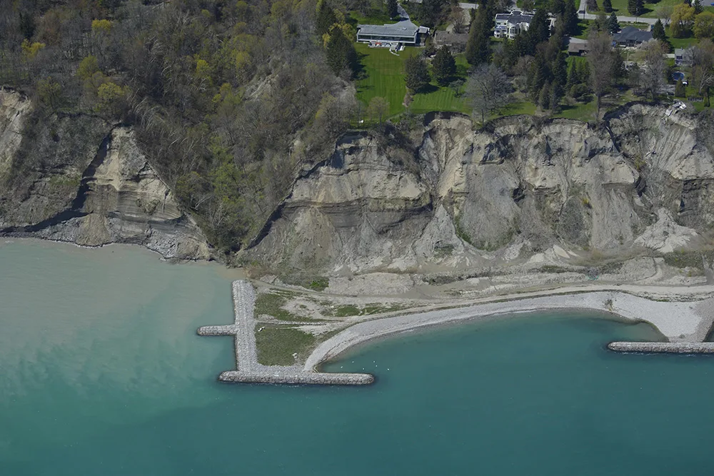
Issue: There is currently limited access along the shoreline, making it challenging and unsafe for users to reach Meadowcliffe from Bluffer's Park Beach.
On-Road Great Lakes Waterfront Trail
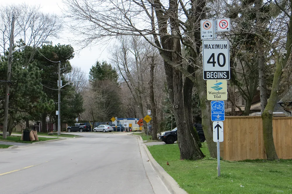
Issue: The Great Lakes Waterfront Trail route currently runs on-road along residential streets in the surrounding community.
What are we doing?
Bluffer's Park Headland
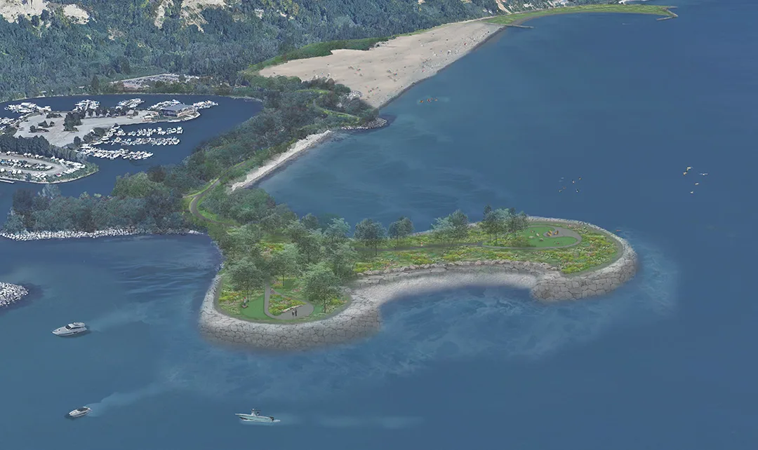
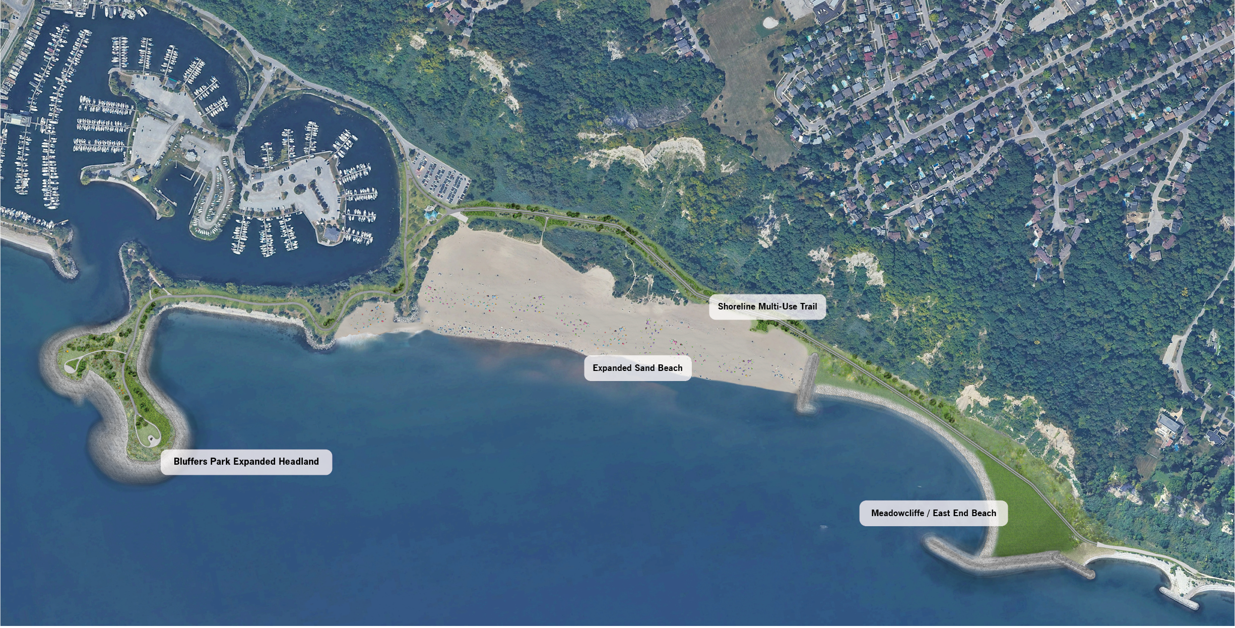
- Expansion of the Bluffer's Park headland (in conjunction with the Meadowcliffe headland) will redirect sand back towards the beach, reducing the need for dredging in the habour entrance and creating safer boating conditions
- The expanded Bluffer’s Park headland will provide significantly larger recreational space for park users with seating areas and carefully crafted views of both the Scarborough Bluffs and Lake Ontario, in addition to opportunities for meadow and successional habitat expansion.
Shoreline Multi-Use Trail
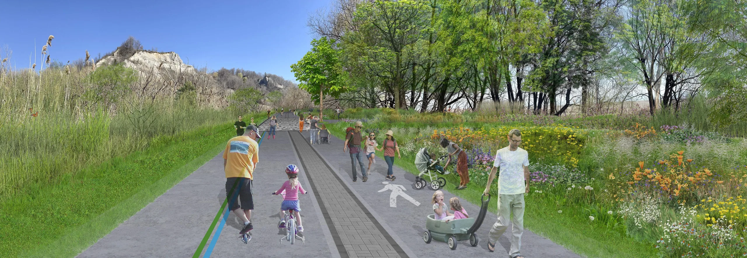
- The shoreline will be made accessible through inclusion of a paved, separated 5.8m wide recreational multi-use trail to accommodate both pedestrian and cyclist usage along the beach
- Additionally, a 4.0m wide paved pedestrian trail will be provided from the east end parking lot out to the expanded Bluffer's Park headland
Meadowcliffe / East End Beach
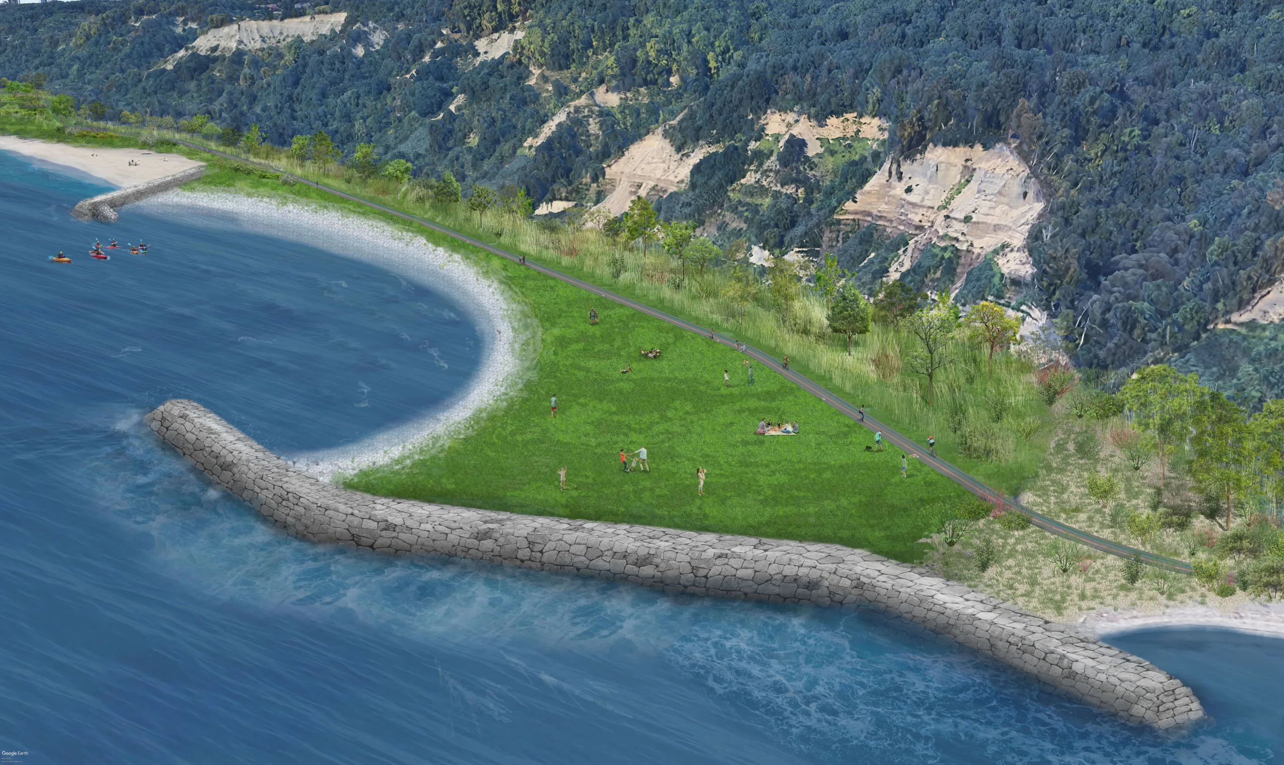
- Expansion of the Meadowcliffe headland (in conjunction with Bluffer’s Park headland) will redirect sand back towards the beach, creating a significantly larger beach area over the long-term that will provide a complete connection from Bluffer’s Park to the Central Segment (Meadowcliffe to Grey Abbey) with more recreational space to accommodate thousands of annual visitors.
- Beach expansion through natural sand accumulation is expected to take decades to provide an instant connection to the Central Segment, an interim groyne will be constructed towards the east end of the beach, with cobble and gravel fill on the east side that will eventually be covered with sand.
- In the future, access to this area will be provided from both the west (via Bluffer’s Park) and the east (via the Central Segment).
Overall Plan
- Through the Project, terrestrial and aquatic habitat will also be enhanced in the following ways:
- Greater movement along the shoreline with improved access to water for terrestrial animals as a result of the larger continuous beach connection
- Increased opportunities for expansion of sensitive beach habitats, such as sand dunes, and stop-over habitat for migratory bird and butterfly species
- Improved underwater habitat for a wider range of fish species due to the introduction of more diverse substrates and habitat structures, and a less linear shoreline profile overall

