Previous Studies
Following the 2017 high-water level event, TRCA in partnership with the City of Toronto undertook the Toronto Islands Flood Characterization and Risk Assessment Project. This study gave TRCA and the City of Toronto a better understanding of the type and location of flood risks at Toronto Island Park. The results of the study are being used to support the development of long-term flood protection measures for the Class EA.
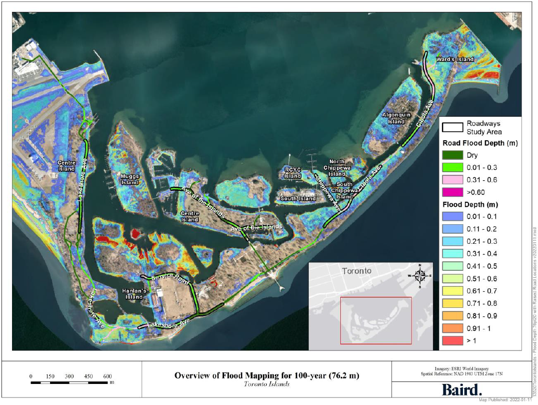
As part of this study, flood depth mapping was developed. These flood maps show the locations across the park that are at risk of flooding during different Lake Ontario water levels. Flood depth mapping for the 100-year flood event has been used for the Class EA to identify at-risk study areas and develop concept designs.
Emergency Works
The first phase of the project was launched in 2020 in the form of emergency works. This work was required in order to maintain essential park services while the larger Class EA planning process takes place. A declaration order was issued to the Ministry of Environment, Conservation and Parks (MECP) which allowed for work to take place in select locations on an emergency basis before completion of the Class EA. As part of the 2020 emergency works:
- Over 500 m of roadway was raised along Lakeshore Avenue and Cibola Avenue to maintain emergency vehicle access
- A beach curb was installed at Ward’s Island to provide protection to the ferry terminal and ensure safe use
- Temporary flood mitigation measures were installed at the Island Water Treatment Plant to help maintain plant operations
Class Environmental Assessment Process
This project is being planned in accordance with Conservation Ontario’s Class Environmental Assessment (Class EA) for Remedial Flood and Erosion Control Projects. This is a collaborative process with the public and other stakeholders which allows for community feedback and participation.
As part of the Class EA process, several alternative solutions (known as concept designs) will be presented. Each alternative undergoes technical evaluation as well as public review and consultation in order to identify the preferred solution. Concepts are typically ranked against each other, as well as the ”Do-Nothing” approach, in order to understand their potential impacts. This Class EA will include the development of different sets of alternatives and the selection of a preferred solution for each of the study areas included in the project.
The following items will be completed as part of the scope of work:
- Collect and review baseline environmental data
- Develop three (3) alternative solutions (concept designs) for each of the study areas
- Evaluate the environmental impacts of the alternative solutions and identify the preferred alternative for each study area
- Host public engagement events to receive comments and feedback on the proposed solutions, including Public Information Centres (PIC)
- Prepare and file an Environmental Study Report (ESR) that documents the Class EA process and reviews the impacts of each of the preferred alternatives

