Project Overview
Learn about the Project background, public engagement, timelines, approvals & guiding documents along with the benefits of the Project.
.
Project Background
Toronto and Region Conservation Authority (TRCA), in partnership with the City of Toronto, undertook an Individual Environmental Assessment (EA) for the Scarborough Waterfront Project (SWP, or the Project) between 2014 and 2019. The Project received EA approval from the Ministry of Environment, Conservation and Parks (MECP) in November 2019.
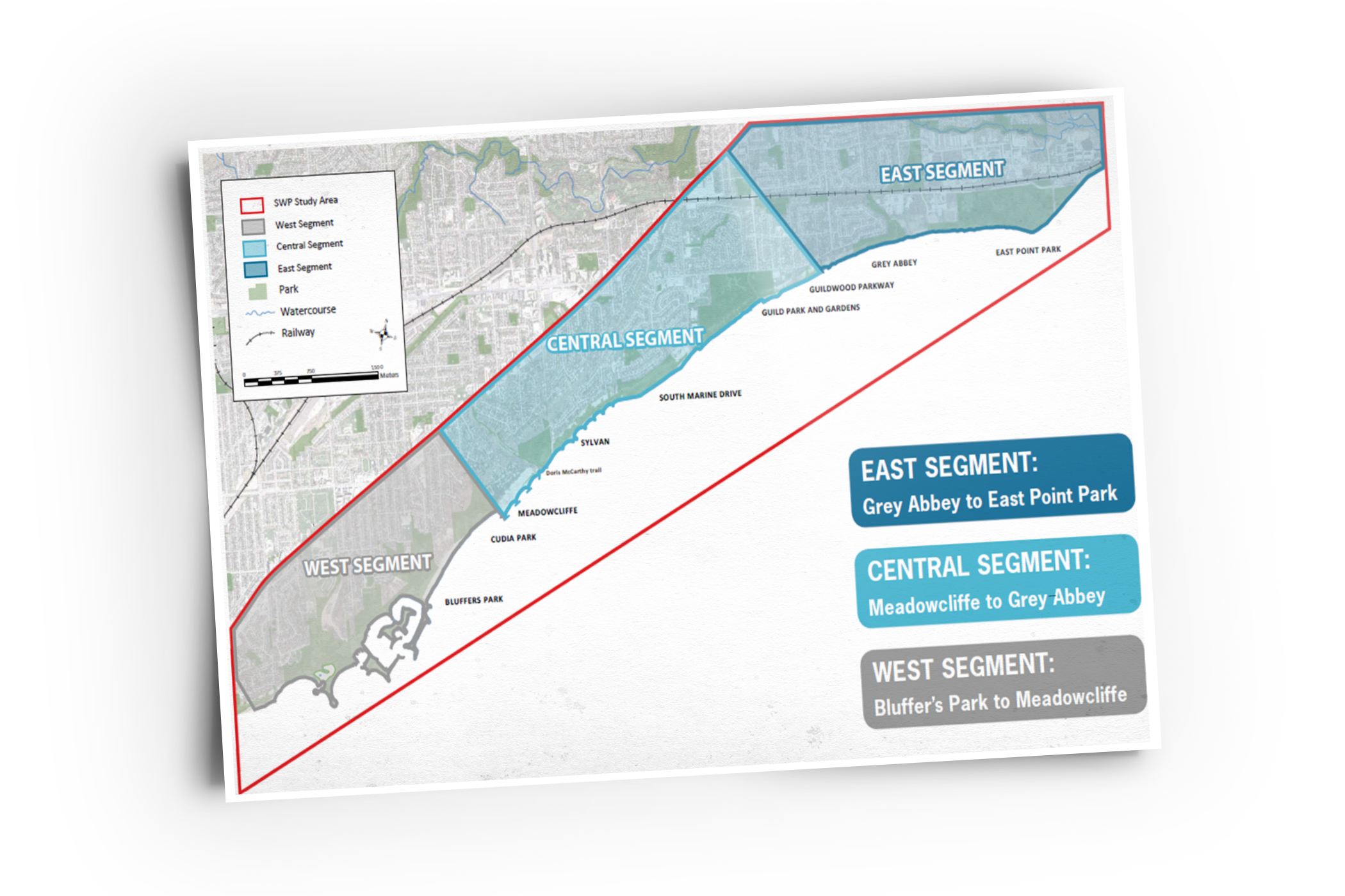
The purpose of the Project is to provide safe public access and an enjoyable waterfront experience, while also protecting and enhancing the natural environment along an 11 kilometre stretch of shoreline between Bluffer's Park and East Point Park in Toronto, Ontario.
Design and construction of the Project will be completed in phases, starting first with the West Segment (Bluffer's Park to Meadowcliffe).
West Segment: Bluffer’s Park to Meadowcliffe
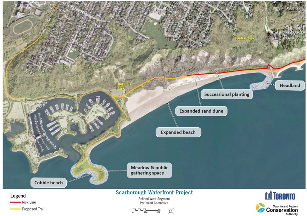
The Scarborough Waterfront Project (SWP) West Segment includes the shoreline between Bluffer’s Park and the existing Meadowcliffe headland-beach system.
The SWP's West Segment has been broken down into two sub-components for design and construction:
- The Brimley Road South Multi-Use Trail Project to provide safe pedestrian and cyclist access to Bluffer's Park for thousands of annual visitors, and
- The West Segment Shoreline and Multi-Use Trail Project to provide an enjoyable waterfront experience and safe public access along the shoreline between Bluffer's Park and Meadowcliffe, with an eventual connection to the SWP's Central Segment (Meadowcliffe to Grey Abbey)
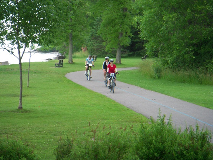
Development of a multi-use trail for pedestrians and cyclists along the east side of Brimley Road South, starting at Barkdene Hills, is a critical element associated with the West Segment that will allow users to safely access Bluffer's Park to enjoy the future shoreline improvements. As Brimley Road will be the only construction access route for the shoreline works, it is imperative that the trail be implemented in advance to facilitate safe pedestrian and cyclist access during shoreline construction.
.
Public Engagement and Reporting Timelines
Significant public and stakeholder engagement was completed through the Terms of Reference and EA phase for the Scarborough Waterfront Project between 2014 and 2019, through a variety of events, public information centres, committee meetings, and targeted individual engagement.
Public Engagement Process Overview
2014 - 2015
- Terms of Reference for Environmental Assessment (EA) Phase
- Two (2) Public Information Centres (PICs)
- 2015 Shoreline Tour
- Indigenous Consultation
- Four (4) Stakeholder Committee Meetings
- Over 300 comment submissions
2016 - 2018
- EA Phase
- Three (3) PICs
- Community Engagement:
- Six (6) Tours and Walks
- 13 Community Engagements with Partner Organizations
- 21 Consultations with Community Organizations and Local Residents
- Dec 2016 - Jan 2017: Larwood landowner meetings
- Over 800 comment submissions
- Indigenous Consultation
- Seven (7) Stakeholder Committee meetings
- Opportunities for public comment at both TRCA Authority Meeting and City of Toronto Executive Committee
2019
- EA Approved by the Ministry of Environment, Conservation, and Parks (MECP) in November 2019
- MECP considered comments raised on final EA document
2020 - 2021
- Detailed Design
- Fall 2020: Initiation of Detailed Design for Brimley Road South Multi-Use Trail
- December 2020: Permit to Enter Private Property for background studies for design
- December 2020 - June 2021: Completion of supporting background studies
- July 2021: General landowner update (letter)
- November 2021: Virtual landowner update meeting
.
Approvals & Guiding Documents
The Brimley Road South Multi-Use Trail portion of the Project supports, and is supported by, a number of approvals and guiding documents, including:

The City of Toronto Official Plan and TRCA’s The Living City Policies, which seek to balance waterfront revitalization with public access, natural heritage, and natural hazard protection and management.

The Scarborough Waterfront Project Environmental Assessment, which was completed between 2014 and 2019, received approval from the Ministry of Environment, Conservation and Parks (MECP) in November 2019.

The City’s Vision Zero Road Safety Plan, adopted by the City in July 2016, which addresses safety for the most vulnerable users of the City’s transportation system – pedestrians, school children, older adults, and cyclists.

The City’s Cycling Network Plan, which supports the advancement of multi-use trails and other cycling infrastructure through Toronto.

City of Toronto Council approval in May 2018 to proceed with design and implementation, pending EA approval by MECP (Resolution #EX.34.5)
.
Implementation of a multi-use trail along Brimley Road South is expected to provide a number of benefits to local area residents and Bluffer’s Park users. Some of these benefits include:
- Safe access to Bluffer's Park for pedestrians and cyclists
- Reduced conflict between pedestrians, cyclists and motor vehicles
- Opportunity for a reduction in vehicular traffic during peak park season through the provision of active transportation facility
- Promotion of healthy living and wellness for the community
- Improved connection to the forthcoming waterfront trail along Lake Ontario


